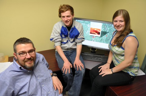
The Okanagan fire mapping team at UBC includes, from left, Geography Professor Jon Corbett, and fourth-year students Aidan Whiteley and Samantha Brennan.
If you live in the Okanagan Valley chances are good you have been affected by a forest fire in some way. Now people’s personal accounts can be shared on a brand-new social media website that features documentation and mapping of every forest fire in the Okanagan Valley over the last 25 years.
Created by two fourth-year UBC students as part of a new course — Cartography and Society — the website uses a newly-developed interface tool called Geolive, which works with Google Maps to enable internet users to add their stories, newspaper clippings, photos and even have real-time discussions about fires that have impacted, or are currently impacting, their lives.
“When we started out on this project we noticed there only seemed to be one dominant theme of forest fires, which was the typical story of people fleeing their homes,” says UBC student Samantha Brennan. “But there are all types of perspectives and experiences — the little kids who watch the planes fill up with water, or the observers who sit out on the lake in their boat, or the people who open their homes to those who are displaced.”
For the students, gathering 25 years of Okanagan forest fire information was an interesting, and at times overwhelming, challenge.
“We sorted through hundreds of pages of news articles about all the Okanagan forest fires and included the major information about each fire — date, geographical area, photographs, news coverage,” says student Aidan Whiteley. “And then we had to actually program a time aspect into the Geolive interface so the fires could be accessed by year on Google Map through a timeline bar.”
The students presented their fire mapping project in March to the Western Division of the Canadian Association of Geographers, winning an award for the best undergraduate presentation.
“It was absolutely incredible to see the support and enthusiasm for our work,” says Whiteley. “A number of people stayed afterwards to ask questions and offer congratulations.”
Like many new social media websites, the students can’t predict all the ways people may use it, although the website does have the potential to be a source of information during a forest fire, as well as a documentation tool.
“This project is about giving a space for those voices often not heard in these sorts of tragedies,” says Jon Corbett, Assistant Professor of Geography. “And it’s highly innovative. One of the classic dilemmas in geography and mapping is how do you incorporate a time dimension into something which is ultimately about space.
“I recently spoke about this project at the Annual Association of Geographers, which is arguably one of the most influential geographer’s conferences in the world, and the response I got was incredible. People were very interested in seeing the time dimension being combined with the mapping data. And to take it and to put it into a context of potentially becoming a useful tool to incorporate user-generated information adds a whole other dimension.”
The Geolive interface tool used to create the project was developed by Nick Blackwell, a web programmer at the Centre for Social, Spatial and Economic Justice at UBC’s Okanagan campus. The student project was supported by the GEOIDE Network.
To learn more visit the website at www.geolive.ca/firehistory.
— 30 —