Location
The Khumbu, Northeastern Nepal
Project
Geological Evolution of the Khumbu Himalaya
Faculty
Irving K. Barber Faculty of Science
UBCO Contributor
Kyle Larson
SCALING THE SIDE OF A MOUNTAIN IN THE HIMALAYA during a snowstorm isn’t for the faint of heart. But for Kyle Larson, it’s a situation he’s found himself in more than once.
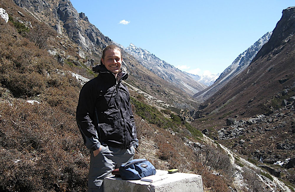
Larson, an associate professor in the Department of Earth, Environmental and Geographic Sciences at UBC Okanagan (UBCO), has visited the Nepal region to explore the Himalaya 12 times — all in the name of scholarship.
“The Himalaya are the best natural laboratory you can ask for if you study mountain building,” says Larson. “As a researcher, I need to go where the mountains are being built right now — despite the often-challenging research conditions.”
Looking to make good on a previous trip cut short by blizzards, avalanches and falling rock, Larson returned to the region in 2019 to continue testing theories on how mountains develop and form, and how convergence is accommodated between colliding continental plates.
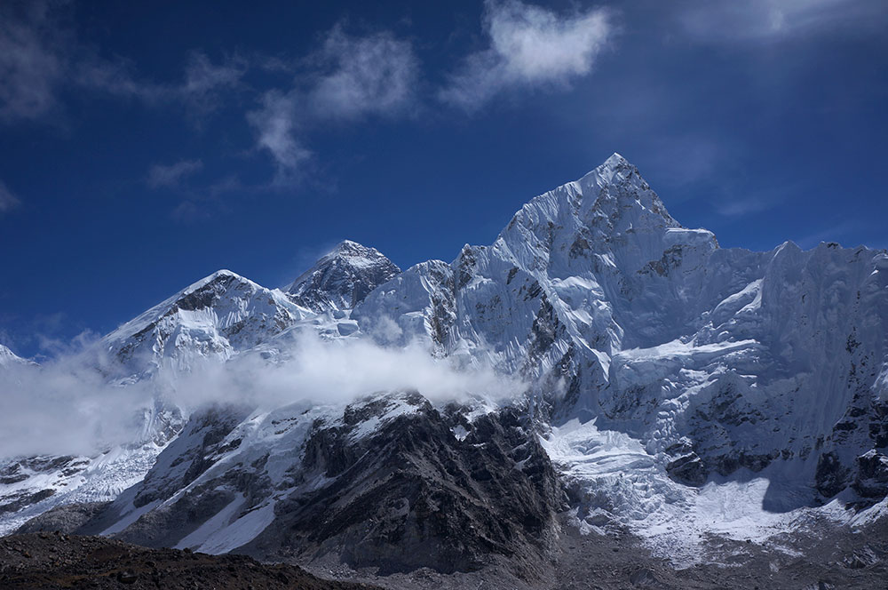
Mount Everest (8,848 m; centre) and Nuptse (7,861 m; right) as viewed looking east across the Khumbu glacier from Kala Patthar (5,550 m). The main climbing route for Everest, called the Western Cwm, is marked by the glacier on the far left.
Wanting to focus on the Everest Massif — a huge topographic culmination in east-central Nepal that comprises Mount Everest (8,848 m), Lhotse (8,516 m) and Nuptse (7,861 m) — Larson, his colleague Félix Gervais from École Polytechnique in Montréal, Québec, a Nepali guide and two porters ventured out for a three-week trek with two main goals in mind.
“Historically, scientists have argued that a fault existed at the base of a massive three-kilometre vertical rock wall that forms the southern flank of the massif,” Larson explains. “Our goals were to look for evidence of this structure in the field and collect specimens for further analyses back in the Fipke Laboratory for Trace Element Research (FiLTER) at UBCO.”
Starting his journey in Vancouver, Larson flew to Guangzhou, China before arriving in Kathmandu, Nepal, where he spent two days adjusting to the time zone and preparing for the trek.
Larson describes Kathmandu as a small city with big-city traffic.
“It’s congested to say the least,” says Larson. “It’s one of those places where it takes 15 minutes to drive somewhere that would take 10 to walk. There’s lots of honking horns all day and night and it’s very dusty — you’re hacking as soon as you arrive. But it is fantastic!”
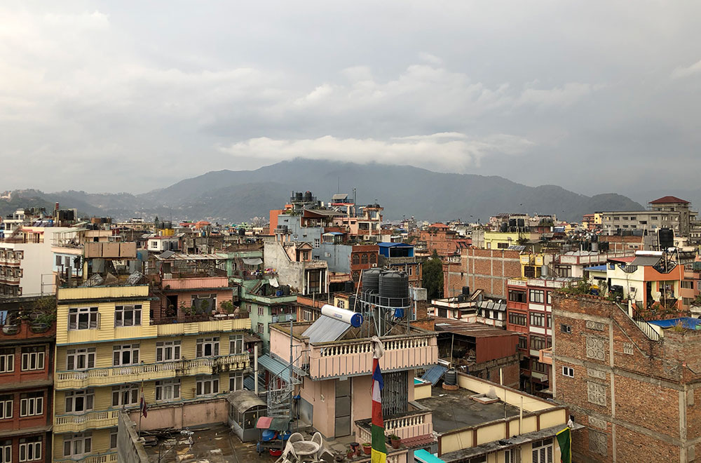
Rooftops across the Kathmandu Valley.
Larson lauds Kathmandu for its fantastically warm and friendly people, endless character and even better food — plus an array of UNESCO world heritage sites to explore related to Buddhism and Hinduism.
“I’ve been there so many times that I’m a little immune to the nuances of the city,” he admits. “It was cool to be there with someone for their first time, because you see the city through their eyes and realize, oh yeah, I guess it is weird to have monkeys stealing my food when I eat lunch outside.”
Following preparations in Kathmandu, Larson and his team boarded a plane and flew into Lukla — widely- known as having one of the world’s most dangerous airports — where they began their five-day, on-foot journey to the jump-off point for their research destination.
“We used established routes to access the areas we needed to go,” says Larson. “It meant we could stay in guesthouses instead of having to pack camping and cooking gear.”
Most guesthouses are small structures made primarily of stone and often have two beds per room and a dining hall. However, guesthouses in the larger villages of Lukla or Namche Bazar can rival the size of hotels in downtown Kelowna.
“There’s no heating or insulation whatsoever,” explains Larson. “Because you’re mostly above tree-level, there’s no fuel for fire, so owners use dried yak dung to start fires in the dining hall, since it burns well. It’s always interesting to think about huddling around this fire of crap — it makes me laugh every time.”
-
Associate Professor Kyle Larson at the Nepalese-Tibetan border in east central Nepal.
-
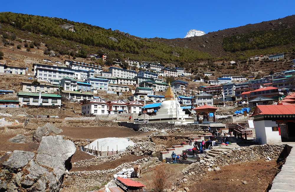
Guesthouses in Namche Bazar.
-
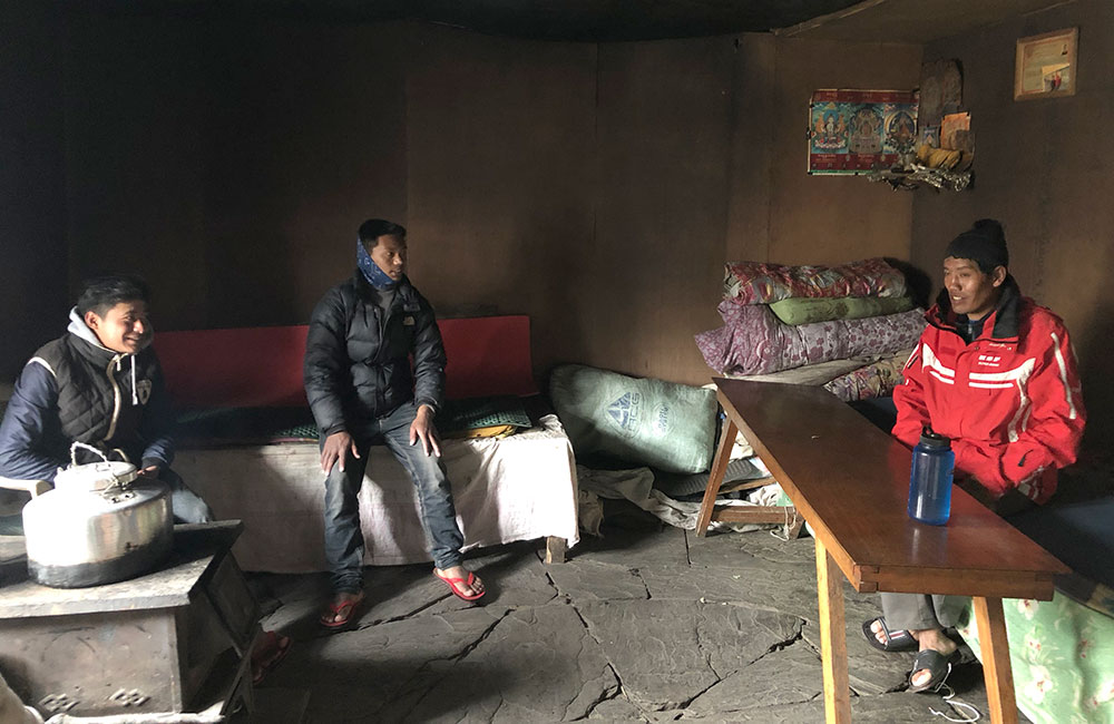
Relaxing in a guesthouse, (from left) porters Pemba and Binod, and guide Pradap Tamang.
-
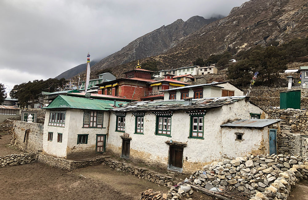
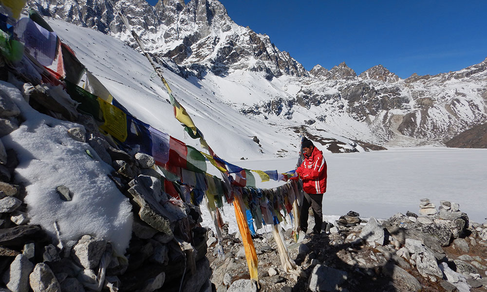
The village of Pangboche, with the red Pangboche monastery in the background.
-
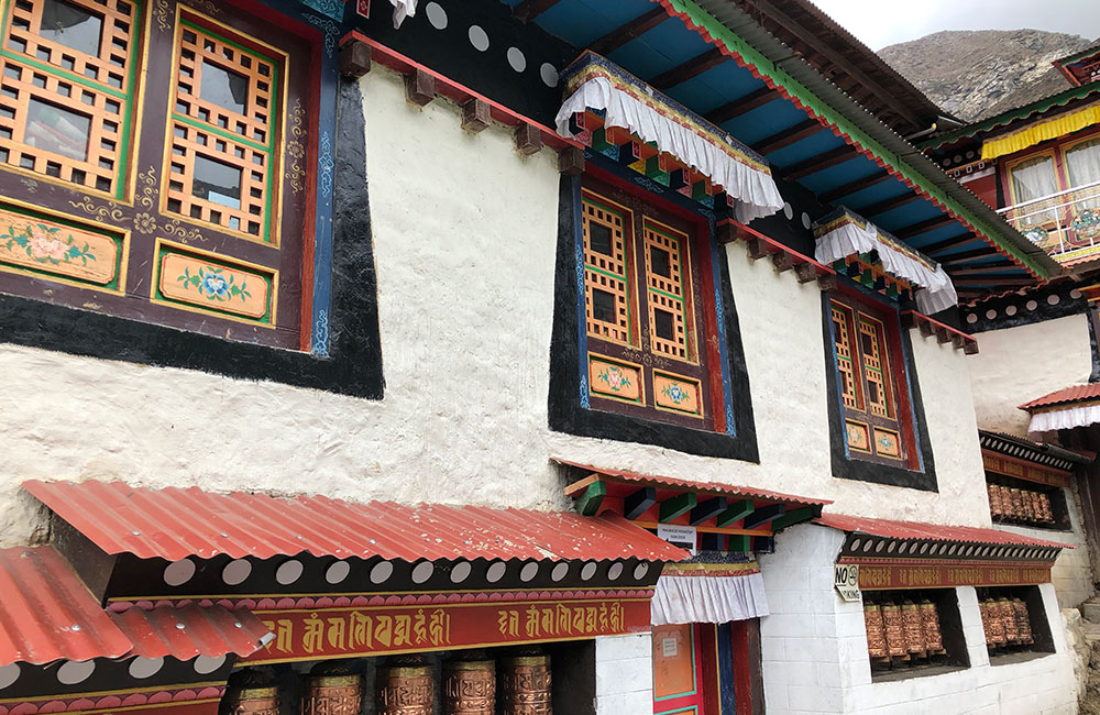
Pangboche monastery, which houses a purported yeti skull and finger bones.
Larson describes the route as very up and down — both literally and figuratively.
“The first day we were going down 200 metres, the next day we’re up 800 then down 200 — it’s all over the place and is referred to locally as a ‘Nepali flat.’
“The first little while I felt fine, but as you start to climb, altitude sickness can hit. Both my colleague and I felt really good the first few days, which led to us ascending quicker than we should have. There were a few days I had a severe headache, lost my appetite and I couldn’t sleep. It felt like I was suffocating when I tried to, and I was having these insane dreams at altitude — it was really bizarre,” Larson recalls, adding that the team actually had to come back down at one point to reset because they had ascended too fast.
“If you suffer a health emergency walking up there, unless an air ambulance can get to you in time, you’re pretty much on your own. That’s why it’s really important not to push yourself higher than your body can handle and acclimatize to each day.”
Walking around 200 kilometres over the duration of the trip, Larson and his team had the opportunity to stop at little villages along the way.
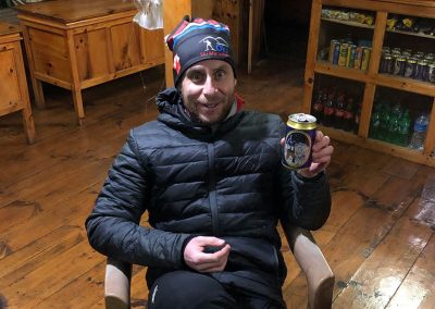
Félix Gervais shares his excitement in trying an “Everest” beer after a long day of trekking.
“Another reason why going the established route makes things a lot easier is because it’s the Everest region and they get thousands of tourists each year. Every hour or so you come across another village, and each usually had a German bakery, where you could have a sit-down lunch and order a beer,” he says.
After taking the time to properly acclimatize to the altitude, Larson and his team finally arrived at the village of Chukkhung, the staging point for their research site.
Over the next few days, they hiked as far as they could along the glacier valleys towards the southern margin of the Everest Massif — the Lhotse-Nuptse rock wall — and began their work examining the granite rock that forms some of the Himalaya, which appear to be everywhere in the Khumbu region.
“We collected a ton of rocks from across the Khumbu for laboratory analyses, and it seems they’re all the same age, about 17-million years-old. That’s a bit odd since these rocks cover such a broad area,” explains Larson.
“We also found rocks that we were expecting to find further up in the valley to be much lower, which started to change how I was thinking about the story these rocks were telling. We found some unexpected things within the rocks themselves, which is exciting and sets up future research.”
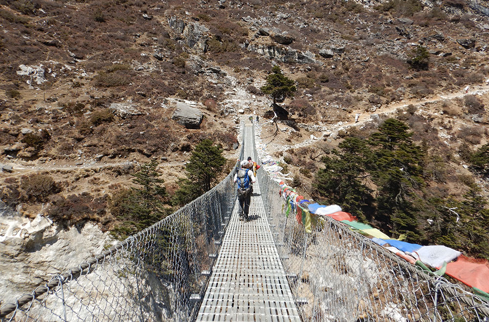
Crossing a suspension bridge across the Dudh Kosi on the way back to Lukla.
Though bad weather closed in on the researcher again and the team couldn’t quite make it as far as they hoped, they were able to identify the various rock types in the area and collect sample material to bring home — ultimately making their backpacks a little heavier for the walk down. But Larson didn’t mind.
“The journey down was glorious — we were all feeling good because after spending time at high elevation, our bodies adapted to the low oxygen levels, so we basically ran all the way back to Lukla,” he says. “I had the samples I needed to do my research and work on papers, and I was excited to get home to see my family. I was also pretty happy to be walking mostly downhill!”
Back at home, Larson will use his lab’s specialized instruments to determine the age of the granite rock collected. The specimens will need to be crushed and specific minerals separated, because only certain materials can be dated.
He points to two minerals in particular called zircon and monazite, which contain large amounts of uranium and thorium that decay radioactively.
“Uranium and thorium decay to lead. There’s this whole decay chain where one isotope will become another through radiogenic decay, and we know how long it takes for uranium and thorium to become lead. So, if we measure how much lead there is in this mineral versus how much uranium and/or thorium, then we can figure out how long it’s been decaying for. From there, we can then back-date to see when the mineral crystallized in terms of millions of years ago.”
-
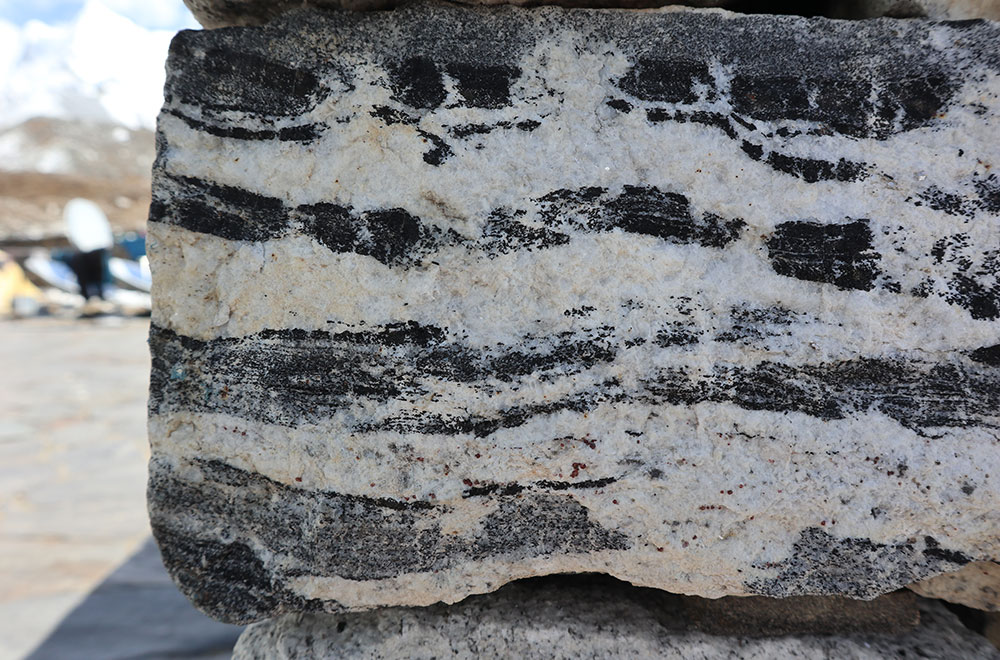
Building stone in the village of Chukkhung. Heated deep in the Earth, the stone melted in situ to eventually form leucogranite.
-
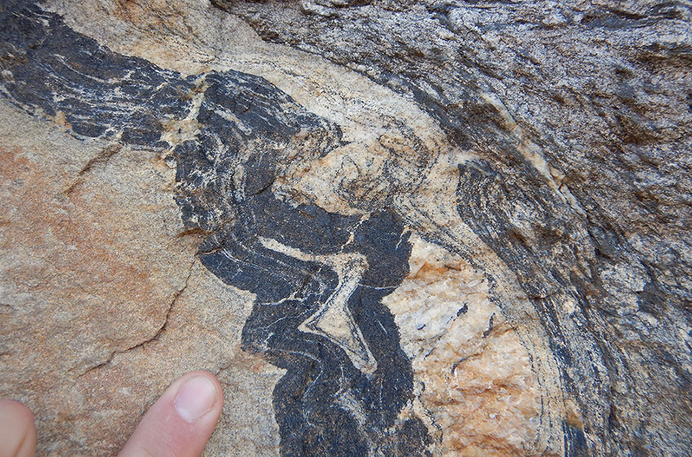
Complexly-folded rocks in the Khumbu region of Nepal that formed approximately 30 kilometres below the Earth’s surface.
-
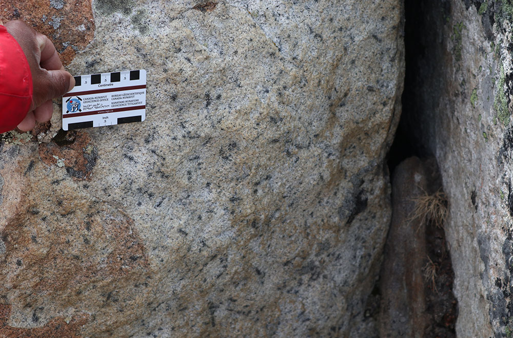
Seventeen-million year-old granite in the Khumbu region of Nepal.
Though it’s largely agreed upon that the Himalaya began to form 55 million years ago, Larson aims to clarify the processes that have developed the mountain belt since then.
“When we look at when a granite or other type of rock crystallized, it tells us if the rocks were just intruded into the Earth and erosion slowly brought them to the surface over time, or if instead, it moved up through the Earth’s crust quickly aided by, perhaps, movement on a fault.
“In the latter case, a fault that helps bring something toward the surface is an exhuming fault, which thins the crust and extends it horizontally. But how would such a structure develop in a mountain building system when the tectonic plates are compressing horizontally and thickening the crust vertically? Being able to answer these types of questions is critical to better understanding not only the Himalaya, but mountain building in general,” he explains.
Larson isn’t sure when he’ll return to the region, given the COVID-19 pandemic, but while there, he was able to identify some related projects that he would like to have a doctoral or master’s student work on — when it’s safe to do so.
“I work in a discipline where research travel is essential to maintaining and increasing subject knowledge. COVID-19 has made that trickier, but I hope my students are still able to get the experience of in-the-field research during their degrees. Nothing you learn in a classroom can compare.”
Larson credits his in-the-field experiences with a higher level of respect from students.
“I cannot imagine how boring my classes would be if I was summarizing a textbook. The fact that I get out there and explore the world and apply the same techniques I’m teaching students in class keeps me relevant and nurtures my curiosity.”
Larson recently published a paper in the Journal of Structural Geology on his previous work at the Everest Massif. All photos are courtesy of Larson.